In 2022, Bengaluru recorded more than 3,800 road crashes which resulted in 772 deaths. 247 of those who were killed, or 32%, were pedestrians. In the eight Indian metros, more than 30% of the deaths are of pedestrians, the second largest cohort after two-wheelers.
Unlike two-wheelers, cars or, say, tractors, pedestrians don’t form a unique group. Every one is a pedestrian at some point during their commute. A bus user has to walk to the bus stop and cross roads. A two-wheeler or car user has to walk to their destination from their parking spot.
While cars get upgraded every few years with newer safety features, and helmets are mandatory for two-wheelers in most cities, pedestrians tend to be the most vulnerable section on our roads. Having walkable footpaths and safe junctions to cross is imperative to ensure safety for pedestrians. The onus to ensure pedestrian safety is thus heavily on the civic authorities.
Walkability in Bengaluru
Sensing Local has recently completed walkability audits across 19 wards in Bengaluru, covering 350km of footpaths and 185 junctions, with the support of over 150 volunteers. Data from the audit is available at www.walkablecities.in.
Data from 10 wards was opened up for participants of the datajam. At the Datajam, participants were expected to dive deep into this data to identify trends and patterns that could give better insights into pedestrian infrastructure in different parts of the city, its impact and identify potential entry points for intervention.
The datajam was conducted in WRI India‘s office near South End Circle in Basavanagudi, Bengaluru. Some of the output/findings from the datajam would be part of the exhibits at ‘Namma Raste’ an exhibition and convening, organised by the Bruhat Bengaluru Mahanagara Palike (BBMP) in partnership with WRI India, under the Bloomberg Philanthropies Initiative for Global Road Safety at the Glass House, BBMP Head Office on the 8th and 9th December 2023.
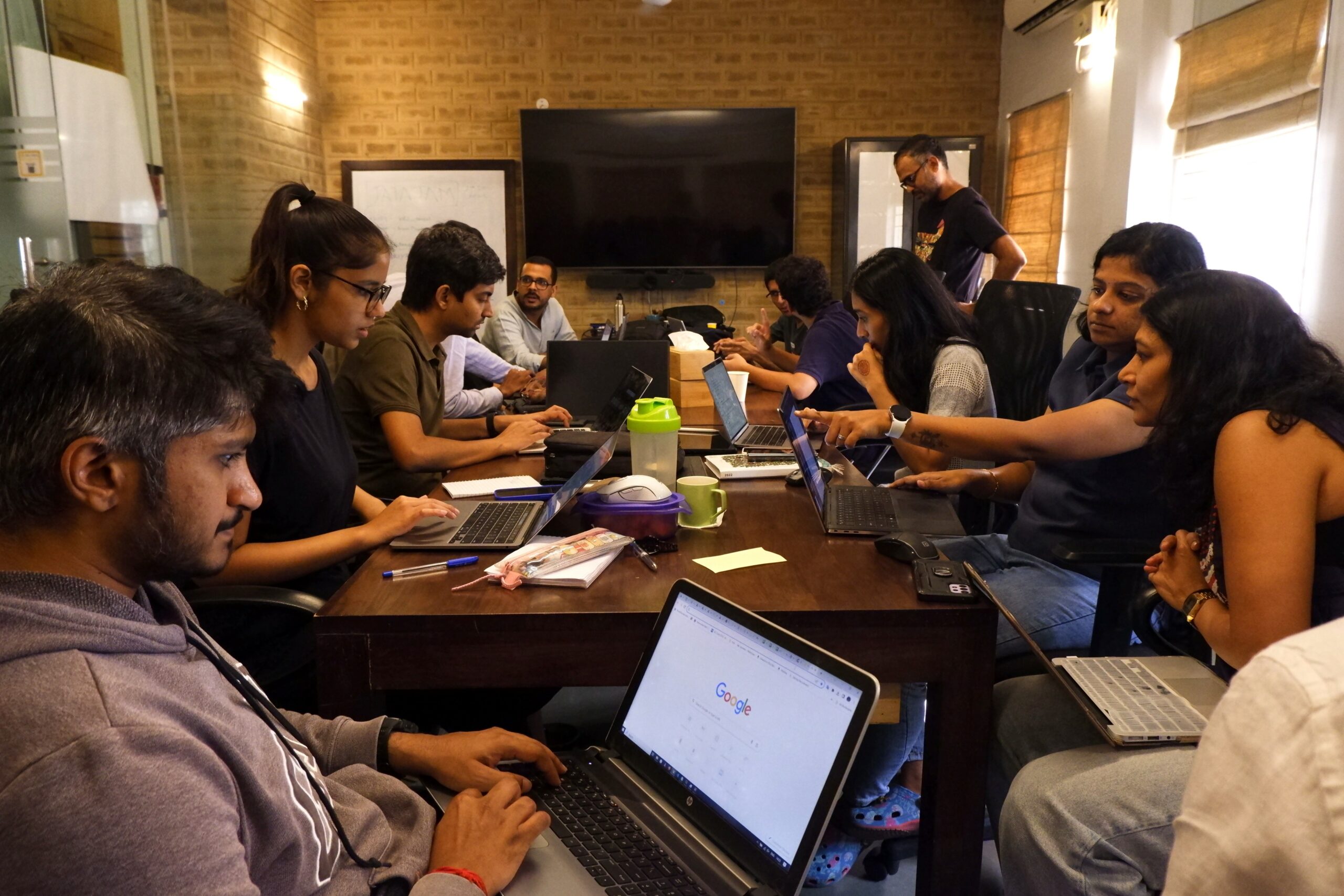
There were 35 participants who were split into six teams. The teams had a mix of urban planners/designers, GIS experts, academicians, volunteers who had taken part in the walkability audits, and active citizens who were interested in the topic.


Problem Statements
Given the existing data from the walkability audits and the ask to bring their own perspectives the teams came up with the following problem statements.
- Improving walkability in HSR Layout Ward with an emphasis on schools.
- To analyze and improve the walkability of senior citizens and children in Padarayanapura Ward.
- Improving pedestrian safety in dark zones in Koramangala.
- Walkability through the lens of presence of and access to footpaths for people who walk to work in Dattatreya Temple Ward.
- A comparison across wards with respect to perception safety in walkability around 100m radius of bus stops during day and night time.
- Analysing ways to improve last mile walkability to metro stations.


Outputs
Walkability in HSR
Deep, Goutham, Inza, Pravar, Neelam and Vivek, of Team 1, named Bengawalk, looked at walkability in HSR Layout Ward, in the context of schools in the area.

For this, they looked at the number of schools, hospitals and clinics in the ward. They identified that there were 18 schools, and 26 hospitals and clinics in the ward. The walkability audits had uncovered 583 issues in the ward of which 416 were within 250m of these places.
Using DISE data from OpenCity.in they identified the schools with the most number of students enrolled and found that they were especially vulnerable due to the issues around them. Using the calculator on the website they estimated that it would cost Rs. 190 Lakhs, or a touch under Rs. 2 crore to fix these issues.


Walkability for Senior Citizens and Children in Padarayanapura
Abhishek, Dinakar, Juhi, Manmayi, Nithya, Rashmi and Suhasini of Team “Chow Chow Path” analysed the walkability for senior citizens and children in Padarayanapura Ward.

The team noted that Padarayanapura Ward was amongst the riskiest wards audited and called out by Sensing Local. There is a high concentration of schools, religious institutions and parks which would be frequented by children and senior citizens.
They used data from the walkability audits, combined it with data from OpenCity on locations of schools and parks, BBMP budget data and data from Mapunity for ward demographics. With this they came up with a score called “resistance level” which they defined as “the level of opposition that a stakeholder may face while trying to fix issues identified by the walkability audit”.
What they found was that there was generally an absence of footpaths, and where there were footpaths they were either broken or too high from the road surface level. There was also an absence of signage like presence of schools which ask motorists to slow down. Obstructions from parked cars, trash and vendors further made it difficult for people to walk. Lack of streetlights also left large spaces dark causing safety concerns.
Their recommendations were broken into low resistance recommendations (which are easier to fix) like laying footpaths and removal of waste, high resistance recommendations (needing more stakeholder involvement) like clearing the roads of parking and vendor encroachments.


Improving Pedestrian Safety in Dark Zones in Koramangala
Anshita, Jithendra, Sailee, Sharad, Srishti and Vidya of Team Ganga looked at the presence of dark zones in a section of Koramangala from the aspect of safety during walking.

The team focused their analysis on two main roads – Koramangala 80 ft road and Srinivagilu Main Road. They used data from the walkability audits and combined it with the BDA Revised Master Plan of 2015.
The team looked at why dark zones occur in the areas analysed and found that while there was a lack of lighting infrastructure in some sections of the road, there were other contributing reasons like presence of tree canopy, pillars from the flyover construction (from St. John’s signal to Sony world, the still incomplete Ejipura flyover), and the absence of human and commercial activities in one section of the road (compound wall of St. John’s hospital campus was the main culprit).
The issues were compounded by the presence of poor footpaths in these poorly lit stretches. The team identified that 32% of the issues seen with broken footpaths in Koramangala ward were from the two roads they analysed.
Regular maintenance of street lights as well as trimming the canopy, along with installing solar reflectors and double lighting were the solutions the team proposed. They also recommended installing temporary lighting on the flyover pillars while they are under construction and permanent ones once they are completed.
At junctions, better maintenance of footpaths and better enforcement of speeding limits along these stretches to make walking safer was recommended.


Access to footpaths for people who walk to work in Dattatreya Temple Ward.
Aniket, Deepak, Deepthi, Madhushree, Ramya and Swati of Team Periyar looked at the availability of footpaths for those who walk to work in Dattatreya Ward.

The team first looked at the demographics of Dattatreya ward and identified the percentage who are likely to be walking to work within the ward to its commercial areas. They combined the data from the audits with the BBMP ward information for the population, household mobility analysis reports from DULT and the economic census data for Bengaluru.
They noted that most of the establishments were owned by single owners and fall in the agriculture and allied activities sectors. They also noted the income disparity in the area where 43% make less than Rs. 10L per annum while 49% make more than that.
Based on the land use data, bus stop locations, population and income data, they estimated that 50% of the population in the ward would walk to work – the non-vehicle owning population. They identified Dattatreya Temple Road as the major road needing improvement.
They found that only 50% of the stretch had footpaths, and where available the footpaths were heavily encroached upon, primarily by parking and then by vendors.
They recommended that the authorities start with building footpaths where there are none. They also recommended a no-parking policy on the roads, and introducing buses so that there are public transit options available. They wondered if some parts of the Dattatreya road could be made pedestrian only.


Safety perception in walkability around 100m radius of bus stops during day and night time
Anshu, Karthik, Kasturi, Soundarya and Veena of team Jogi Walkers analysed the data from the perception of safety during both day time and night time around 100m from bus stops.

The team noted that walking behaviours vary between day time and night time. While there could be multiple destinations and trip-chaining during day time leading to more walking and public transit usage, during night time there is usually a primary destination – either residential or commercial – and much less walking. They used data from the audits and combined it with bus stops location and routes data for their analysis.
The team found that with footpaths in a 100m radius around bus stops, the main issues seen were broken footpaths, large level difference from the road surface and lack of footpaths. At night time, the main issue that affects walking was thus the quality of footpaths followed by encroachment. During day time, similar issues were seen where footpath quality continues to be the main issue followed by encroachments.
The only difference seen was that issues of dark zones and lack of streetlights don’t play a role during day time. They also noted that these unsafe zone issues are more common in inner wards than outer wards.
The team recommended that wards in outer zones need immediate attention as footpath quality issues are seen more there than in inner zone wards. They also suggested doing a bus stop level audit to collect more data on footpaths around public transit points.


Last mile walkability to metro stations
Aishwarya, Manojna, Praveen, Rohit, Sireesh and Vijayshree of team Fluffy Cagers analysed the data for ways to improve walkability to metro stations.

The team used walkability data from the audits and combined it with metro locations data from TheMetroRailGuy to look at the state of footpaths around metro stations.
Similar to what was noticed by other teams, broken footpaths, large level difference from road surface were the main issues seen. Low-hanging wires and encroachment by parking were the next two differences they found around metro stations.
They found that walkability is affected by feeder roads around major public transit stations and needs to be prioritised in order to improve last mile connectivity.


Conclusions
The teams analysed the walkability data from multiple perspectives – access for school children, senior citizens, public transit and safety. The analysis was for specific wards in some cases, and around public transit points across wards in others.
The quality of footpaths – broken footpaths or too high from the road surface – and the absence of footpaths were the main issues seen in most of the analyses. This was followed by encroachments – parking, trash and vendors.
As one of the teams identified, the cost of fixing broken footpaths is very less compared to other action items and it is something the authorities can concentrate on at first priority.
Going forward, Ankit Bhargavan, co-founder of Sensing Local, noted that “we hope this data jam is the first of many efforts. We look forward to scaling up the walkability audits and involving more communities and other stakeholders to enable more evidence-led creation of local projects that make our neighbourhoods safer, more inclusive and liveable.”
For the immediate next steps, Ojas Shetty, Senior Programme Associate, WRI India, said that “the results from this data jam will prove useful for designing projects for the Brand Bengaluru initiative, which is focussed towards creating safer, inclusive and resilient streets for Bengaluru.”
For the participants, it was a great way to engage with their city and its challenges. “While we didn’t get to analyse the Walkable Bengaluru data completely due to the limited time, getting to see the ways that different teams came up with problems statements and potential solutions is a great start to bringing more public engagement in such everyday issues that everyone faces,” said Vivek, a participant in the datajam.
For OpenCity.in the main purpose is civic engagement on issues facing the city. “Teams came together to explore issues of roads and footpaths, through the lens of data. The exercise helped them understand the complexity of solving a common problem that affects all of us living in the city – the idea of walkable cities resonated with everybody,” said Meera K, managing trustee of Oorvani Foundation.
