Different Indian states made public geo-spatial data about their states as well as important cities. This includes, among other things, important data like the following:
- Administrative boundaries – districts, taluks, wards, constituencies, police jurisdictions.
- Data on public amenities – bus stops, public toilets, public parks.
- Utilities – electricity, water. This includes administrative boundaries for the utilities as well as their assets – like water lines, sewer lines, sewage treatment plants, electricity poles, etc.
- Education – schools, colleges etc.
- Health – Locations of anganwadis, Healthcare centers, UPHCs, clinics, dispensaries.
- Environment – waterbodies, forests, protected areas, eco-sensitive zones (ESZs)
- Transportation – railway, metro and road networks.
Public domain Geo-spatial data:
Not all states have made their data public. Some of the important ones that can be used are listed here:
- Survey of India. The Survey of India, part of the Ministry of Science and Technology has made official district and states map public for free. There are other maps that can be purchased from their site for a (hefty) price.
The maps are in shapefile format, and while being good, suffer from poor labelling. Karnataka is labelled as Karn>taka. Bidar is BIDAR. The nomenclature of districts does not follow official state government nomenclature. But they are accurate and official markers of district boundaries. - Mumbai:
- The Bruhanmumbai Municipal Corporation (BMC) has exposed detailed maps of Mumbai through their rest API. The rest URL for the site is: https://services8.arcgis.com/r6MmJtuWAzMawmJ8/ArcGIS/rest/services. Same as in the above point, you can click on the URL and navigate the directory.
- You can also find data from BMC in this rest URL: https://mybmcid.mcgm.gov.in/server/rest/services.
- Karnataka/Bengaluru: Karnataka State Remote Sensing Applications Centre (KSRSAC), Govt of Karnataka is the GIS entity of the Government of Karnataka. Unlike in other states/cities, there are multiple servers that can be explored for Karnataka related data. They are:
- https://dev.ksrsac.in/maps/rest/services
- https://kgis.ksrsac.in/kgismaps/rest/services
- https://kgis.ksrsac.in/kgismaps1/rest/services
- https://kgis.ksrsac.in/kgismaps2/rest/services
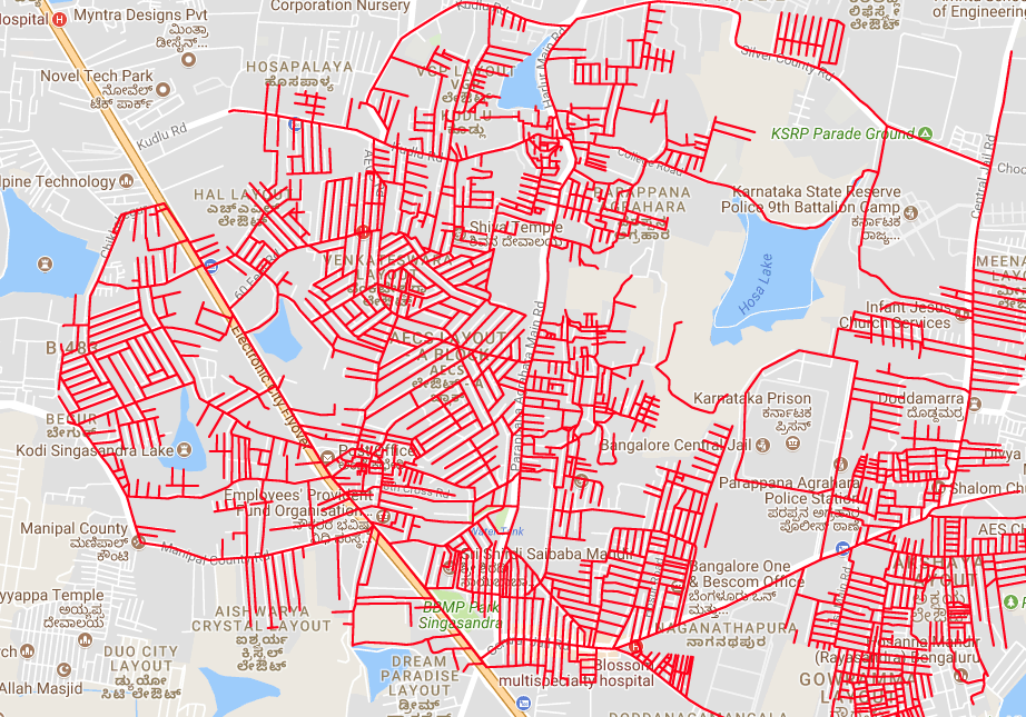
- https://gisapp.bbmpgov.in/arcgis/rest/services has extensive BBMP related maps.
Not all of these URLs can be loaded on a browser and explored. You will have to use an app like QGIS to explore them (explained later).
- Telangana/Hyderabad: Telangana State Remote Sensing Applications Centre (TRAC), Government of Telangana, is the Government entity in charge of publishing GIS and maps for the state. The URL for Telangana and Hyderabad is: http://tgracgis.telangana.gov.in/arcgis/rest/services. This URL can be opened in a browser and explored.
- Tamil Nadu/Chennai:
- Greater Chennai Corporation’s maps with data on flooding and boundaries can be accessed through their rest URL: https://gis.chennaicorporation.gov.in/server/rest/services/
- Tamil Nadu Geographical Information System (TNGIS), Government of Tamil Nadu is the government body in charge of publishing state level maps. The rest URL for their site is: https://tngis.tn.gov.in/geoserver/rest/services. However, the data in the case of TN is not public and is hidden behind a user/password.
- India WRIS: India Water Resources Information System contains extensive maps about rivers as well as their basins and sub-basins. Their rest URL is: https://arc.indiawris.gov.in/server/rest/services/.
- Living Atlas ESRI is a collection of maps from multiple servers. It has interesting datasets like ward maps for many cities including tier-2 cities. Their rest URL is: https://livingatlas.esri.in/server/rest/services/
- WebGIS: WebGIS is also known as Bharat Maps and it has all India data like constituency maps and delimitation maps. You can find the maps at: https://webgis1.nic.in/publishing/rest/services/
How to download the maps data:
There are two ways to download the data.
Method 1:
The first method is using a command line tool – esri2geojson. The steps are detailed in an earlier explainer. You can read it here.
Method 2:
You will need QGIS for this, and you can download it here. Note that QGIS is a heavy software and the download itself is 1 GB on Windows.
The steps are as follows:
- Open QGIS. In the menu at the top, click on Layer-> Add Layer-> Add ArcGIS REST Server Layer.

- This will open a dialog box. Click on New. And in the dialog box that opens, enter a name like “Indian Atlast ESRI” and the URL from the earlier section into the URL field.
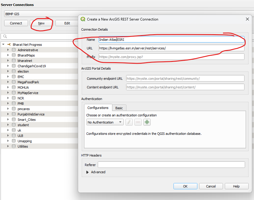
- Click “OK” and you are all set. Select the connection which can be accessed as a dropdown in the “Server Connections” and click on “Connect”.
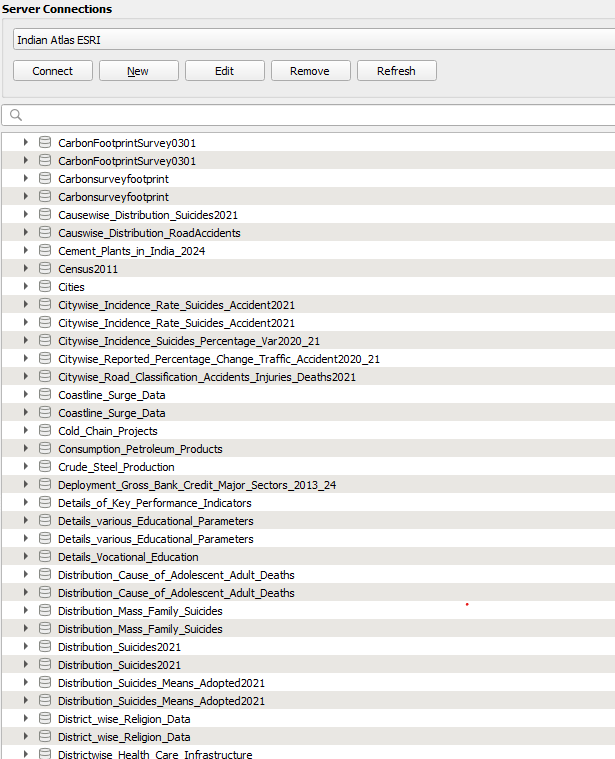
- You can browse the directory and load the map directly on QGIS, or use QGIS to get the URL for the map to download using the esri2geojson method.
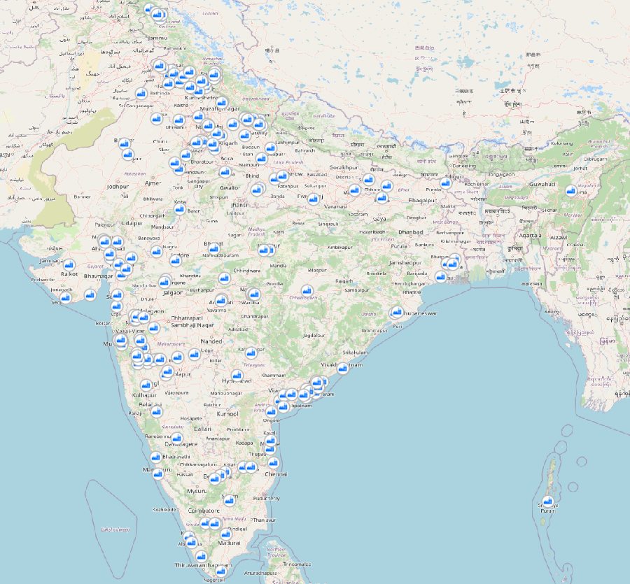
To load the map on QGIS, browse down to the final map for e.g. Cold Chains in India, and click add.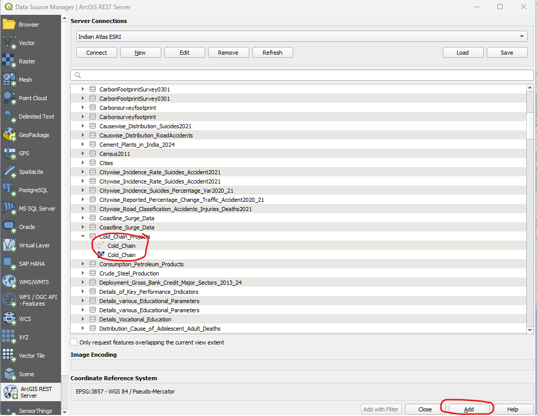
- This will load the map into QGIS main window. In this case you can see the locations of all the Cold Chains across India.
- You can click on the loaded map in the bottom left panel and select “Export” -> “Save Features As”. This will be open a dialog window where you can choose the format to export into: KML, GeoJson or Shapefile, etc. Browse to where you want to save it, give a name for the file, and press “OK”.
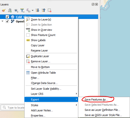

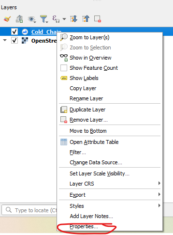
And that’s it, the map is saved on your hard drive! - On the loaded map, right click and open its properties. Go to the “general information” at the tab at the very top. You can find the URL of the map in that tab.
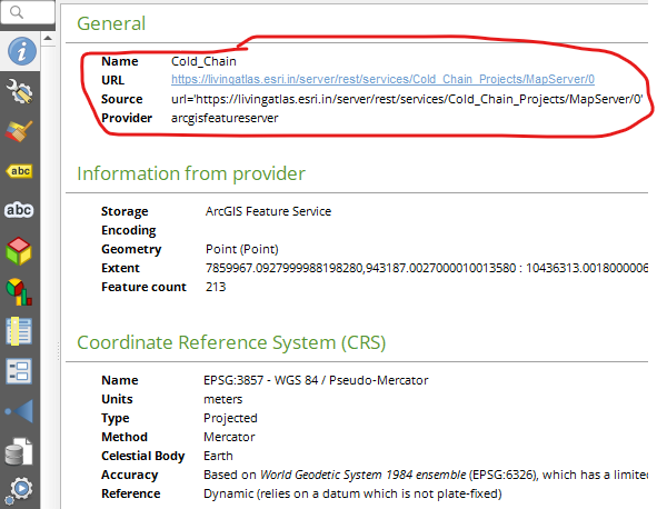
- In the above example, we got the URL for cold storage chains across India at this URL: https://livingatlas.esri.in/server/rest/services/Cold_Chain_Projects/MapServer/0. You can use this with esri2geojson and download the map file in geojson format.
Some points to remember:- Load the icon shown in Blue, not the one in Red to get the URL. The Blue one is the MapServer, the red is the FeatureServer and might not work correctly all the time.

- Load the icon shown in Blue, not the one in Red to get the URL. The Blue one is the MapServer, the red is the FeatureServer and might not work correctly all the time.