Tag: MAPS
-
Explainer: How to view and interact with KML files
KML stands for Keyhole Markup Language and it is an XML based format for map files. These files contain map related data which can be divided into three types. They are: The map data stored on OpenCity.in is usually in the form of KML files and can be viewed on our OpenStreetMap base (which is Continue Reading
-
How to Download Maps from GIS websites
Many map sites as well as public utilities put out their maps for public consumption. This data is exposed in the form of Rest URLs and can be downloaded as map files with the right tools. What you need How to download map files Continue Reading
-
Economic Survey of Karnataka 2021-22 in Maps
The Government of Karnataka published the Economic Survey of Karnataka for 2021-22. This is a comprehensive document with details about the Gross Domestic Product at state level (GSDP), at district level (GDDP), as well as district and state level per-capita income. It also includes details about the education sector, farming, industries, services and health. What Continue Reading
-
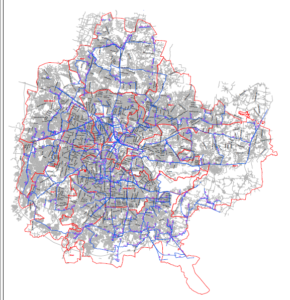
How to extract maps from pdfs
Many public departments put out maps in the form of pdfs instead of map file formats (kml/kmz, shapefiles or geojsons). These maps are usually generated with Autocad and you can see layers on the map which resolve as you zoom deeper. Extracting the map layers from pdf to geojson This explainer will walk you through Continue Reading
-
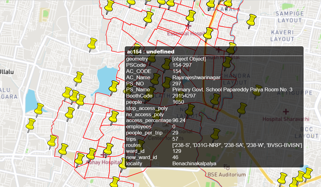
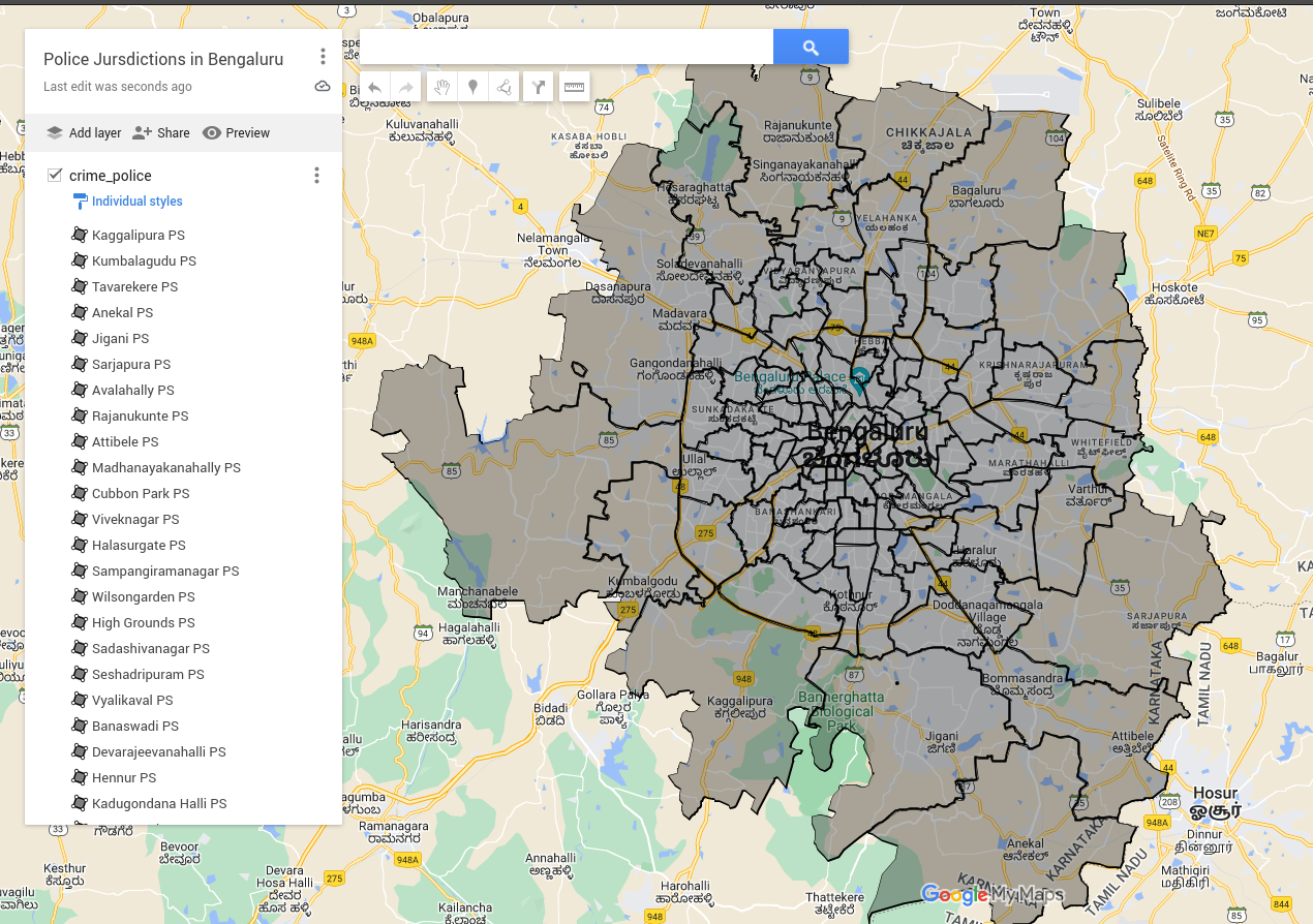
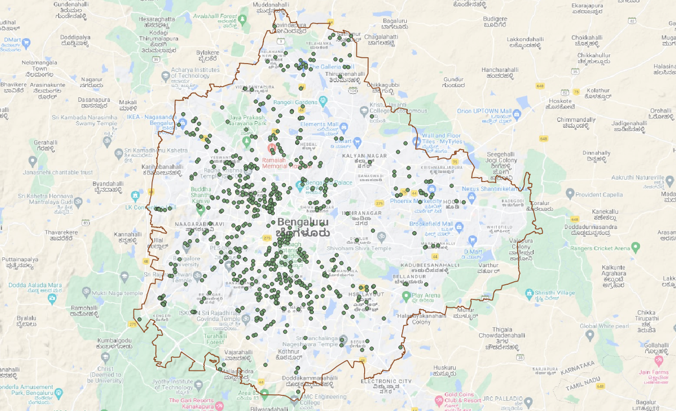
Understanding the BMTC bus stops and routes data
Recently three Bengaluru techies got together to map the BMTC bus stops information. The information they managed to map wasn’t just bus stops, but also bus accessibility and other details at the booth level. A booth is the smallest administrative unit, smaller than a ward. The information here at booth level includes information like the Continue Reading