
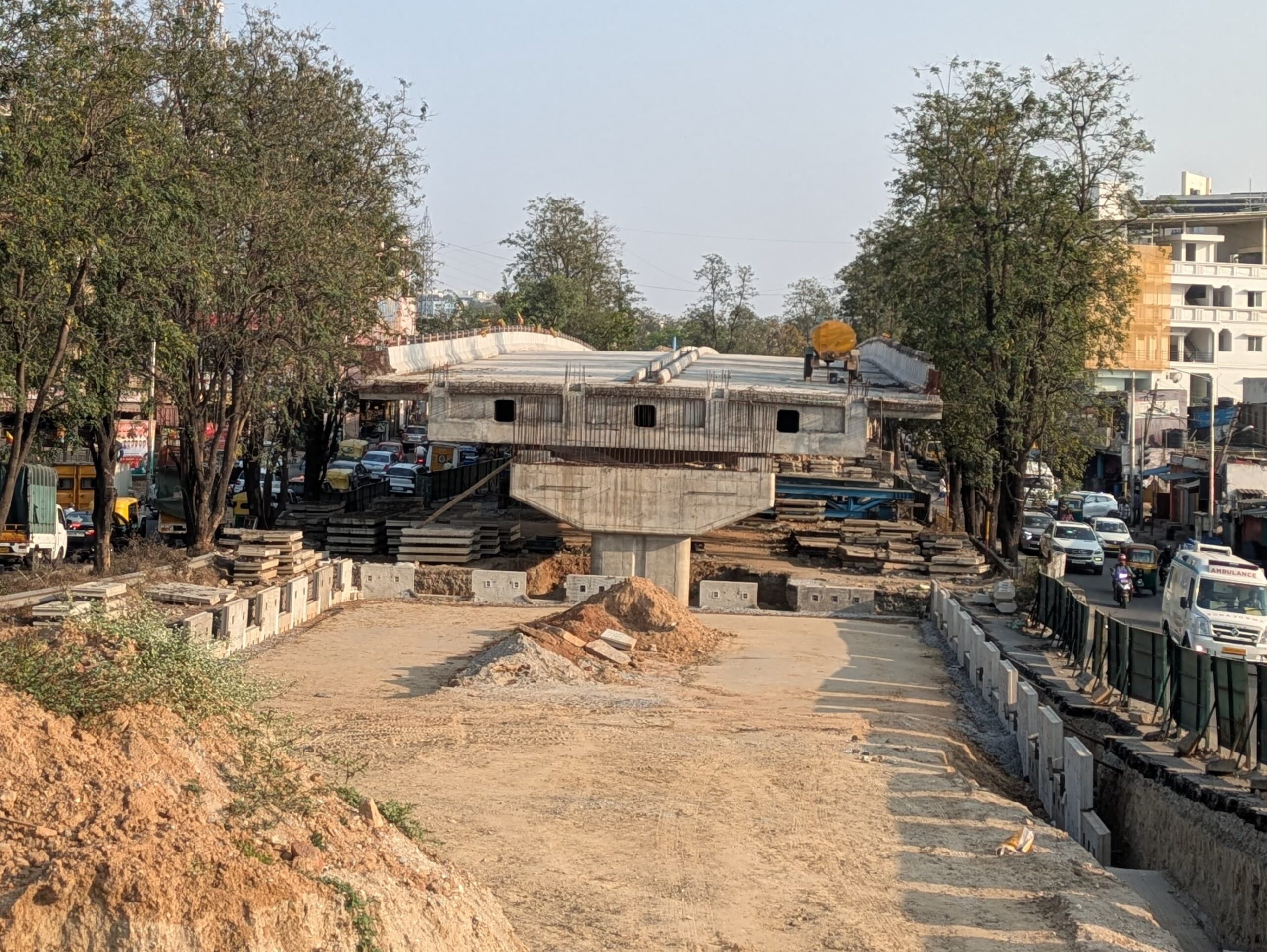
On Thursday, 10th October 2026 OpenCity organised the launch call for the Elevated Corridor Design Challenge, a month-long challenge that asks citizens to evaluate the Greater Bengaluru Authority’s proposed elevated corridors and design better alternatives.
The call introduced the Elevated Corridor design challenge, its timeline and what participants will need to submit. It then featured three expert sessions: Vivek Matthew explained the 13 proposed elevated corridors, Ashwin Mahesh taught us how to approach infrastructure proposals like these, and Prachi Gupta gave a session about ecological impact and Rapid Environment Impact Assessments (REIA).
This article explains the challenge from the start: what is being proposed, how the challenge works, what you would submit, and what the three experts covered.
Register for the Elevated Corridor Design Challenge here: https://forms.gle/tSxLJpw4ezv2Vy2c8
The Challenge
The Greater Bengaluru Authority (GBA), through its infrastructure arm BSMILE (Bengaluru Smart Infrastructure Limited), has proposed 13 elevated corridors, or flyovers, across the city. Tenders had been awarded for nine of them, tenders had been published but not awarded for two more, and two were planned but not yet published. As of the 19th October, the government has cancelled eight of the nine awarded tenders and is expected to cancel the ninth, so these projects will go through re-tendering. Based on the projects’ Detailed Project Reports (DPRs), the total cost was expected to exceed Rs 12,000 crore.
Projects of this scale reshape streets, neighbourhoods and public spending for decades. The proposals have been pushed ahead with little consultation and many of the people who will be affected have not been consulted at all. Alternative options for reducing Bengaluru’s traffic have not been explored, therefore this challenge is meant to give citizens a structured way to develop better ideas for decision makers.
The goal of the Elevated Corridor Design Challenge is to evaluate any one of the GBA’s proposed elevated corridors, assess its merits and drawbacks, and propose sustainable alternatives that serve the area’s mobility needs.
OpenCity usually runs one-day Jams and events, the reason we are introducing a month long event is because a topic this large needs people from different disciplines and enough time to understand how to get involved. The hope is that the challenge produces many creative and feasible ideas, drawn from communities and neighbourhoods, that can be put in front of the city’s stakeholders, and that it moves the discussion past knee-jerk reactions. The goal is not to immediately dismiss a proposed elevated corridor, but rather asses how solutions for mobility between these corridors can be better assesed.
How the Challenge Works
The challenge opened with a launch call on 15 October and runs until the final submission on 15 November.
- Initial designing period (15 to 25 October): participants choose a corridor, look for teammates and start developing early ideas, using the documents and datasets shared by OpenCity.
- Design jam (25 October, 9 AM to 3 PM, Samagata Foundation, Church Street): an in-person working day where teams are formally registered, proposals are developed, participants see how others are approaching their corridors, and experts and affected stakeholders give feedback.
- Final submission (15 November): each team submits a report.
- Shortlisting and jury: the best submissions are shortlisted, and those teams present to an expert jury of decision makers. Details of the jury and the prizes will be announced at the design jam.
The Design Jam
The design jam is a working day on 25 October, from 9 AM to 3 PM at the Samagata Foundation on Church Street, where participants come together in person to turn early ideas into proposals. You do not need to arrive with everything prepared, a confused starting point is fine and the day is about fleshing things out together and having a clear plan for proposed alternative.
Teams will be formally registered and finalised on the day and will work through their proposals, see how other participants are approaching their corridors, and get feedback from technical experts and from stakeholders such as citizens affected by these projects.
What we expect participants to do before the day.
- Start looking for teammates, whether friends, colleagues or people you have met through the challenge.
- Pick a provisional corridor or site, ideally in an area you know.
- Read the proposal documents for that corridor and assess its assumptions, risks and drawbacks.
- Bring early ideas or sketches.
- Research the site through visits and conversations with residents, street vendors and commuters.
- Bring any questions you have for the experts.
What to Submit
Each team submits a PDF report of at most five pages, excluding optional annexures. The report should include:
- Context: the site, the problem and the groups affected.
- Review of the current proposal: its assumptions, risks and drawbacks.
- Your proposal: an improvement or an alternative, supported by maps, drawings or diagrams.
- Comparison: how your proposal compares with the existing one.
- Impacts: effects on mobility, accessibility, public space, communities, livelihoods, heritage and the environment.
- Local perspectives: how local views were considered.
- Action plan: how it would be implemented, including phasing and the departments and stakeholders involved.
- Sources: the data, reports, observations and consultations used.
- Team details: names, email addresses and byline.
Maps and diagrams should have labels, legends, north arrows and scales where relevant. The datasets, including the DPRs of the corridors, bus and metro data and lake data, are on OpenCity and will be shared with registrants in a spreadsheet.
An external jury will score each submission against this rubric.
| Criterion | What the jury should assess | Weight |
| Understanding of the site and problem | Does the submission clearly explain the site, problem, affected groups, and wider context? | 15% |
| Quality and relevance of the proposal | Is the alternative thoughtful, context-sensitive, and responsive to the identified problem? | 20% |
| Mobility, accessibility, and public-space outcomes | Does it address different users, transport modes, accessibility, crossings, and connections? | 15% |
| Social, environmental, heritage, and livelihood impacts | Does it identify who benefits, who may be adversely affected, and how impacts could be managed? | 20% |
| Feasibility and implementation pathway | Does it acknowledge constraints, assumptions, responsibilities, risks, and possible next steps? | 15% |
| Local perspectives and evidence | Does it use relevant data, observations, consultations, or publicly available information responsibly? | 10% |
| Clarity and accessibility of communication | Can a non-specialist understand the proposal? Are the text, maps, drawings, diagrams, and terminology clear and accessible? | 5% |
| Total | 100% |
Frequently Asked Questions
Who can take part, and do I need a technical background? Anyone interested in Bengaluru’s mobility can take part. No professional experience is needed, though backgrounds in urban design and planning, architecture, transport engineering, ecology, GIS and data, and policy and law will help, as will lived experience as a commuter, resident or street vendor. The work is conceptual, so a good understanding of the city matters more than structural detail, and resources will be shared to help with the concepts.
Do we work in groups or individually? We recommend teams of up to five people with a mix of expertise and local knowledge. Start looking for teammates now, whether friends, colleagues or people you meet through the challenge. You do not need a full team before 25 October: teams are finalised at the design jam, and the organisers will help anyone who needs one. Each team works on one corridor, and you can meet others looking at the same corridor at the design jam. Every participant registers individually, including each member of a team.
How much time should we commit? About 20 to 25 hours per submission over the month, though it is not a fixed amount: around 1.5 hours for the launch call, 4 to 6 hours before the design jam, the six-hour design jam itself, and another 10 to 12 hours afterwards to finish the report. Shortlisted teams will need a few more hours to prepare for the jury.
What should our proposal be? There is no prescribed answer. A team can improve a design, relocate a corridor, replace it with something different such as dedicated bus lanes, or conclude it should be scrapped. You choose whether to look at the whole corridor, a segment or its ramps and nodes. Pick an area you know well, and keep your own bandwidth in mind.
What format should the submission take? The evaluation rubric and a list of expected contents are provided as a guide. Interactive outputs such as a website can be linked from an appendix, but the main idea must be written up in text within the five pages.
What if I cannot make the design jam? You can still submit. The design jam is an extra working day with expert help, and teams are encouraged to attend together, but it is not required.
What Happens Next
Anyone who wants to take part in the challenge can register here, and every member of a team must register individually. Registrants will receive any relevant presentations, the datasets list and the evaluation rubric by email, and questions can be sent to the organisers at any time.
The next step is the design jam on 25 October, from 9 AM to 3 PM at the Samagata Foundation on Church Street, where teams will be formed and proposals developed with support from the organisers and experts. Final submissions are due on 15 November, and details of the jury and the prizes will be announced at the design jam.
Register for the Elevated Corridor Design Challenge here: https://forms.gle/tSxLJpw4ezv2Vy2c8