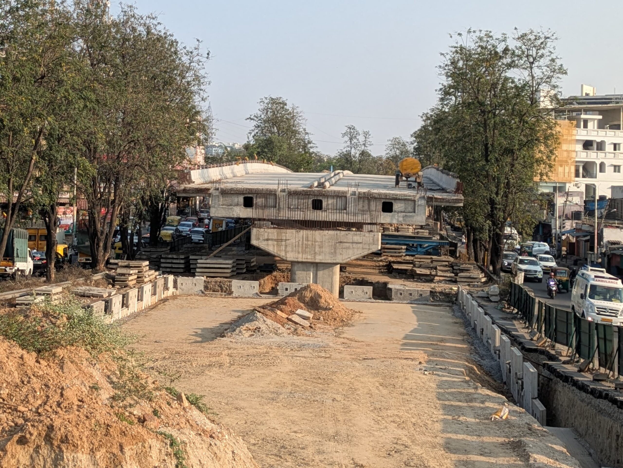
The Greater Bengaluru Corporation through its infrastructure arm – BSMILE – floated tenders to construct nine flyovers or elevated corridors across the city. These nine flyovers range from a length of a few hundred meters in Tumkur Road and Kanakapura Raod, to multiple kilometers in other parts of the city like Adugodi, the CBD and Indiranagar-Koramangala. Two more flyovers have been added to this list, one along Pipeline Road next to Kanakapura Road connecting Ragigudda to NICE Road at Thalagattapura, and the other connecting Yeshwantpur and KR Puram via IISc, Mehkri Circle and Jayamahal Road.
Based on the Detailed Project Reports (DPRs), the total cost of these corridors is expected to be Rs. 12,432.77 Cr with the Yeshwantpur to KR Puram corridor expected to cost the highest at Rs. 4621.45 Cr, and the MEI junction flyover costing Rs. 52 Cr at the other end.
Details of the corridors
| Name | Cost (Rs. Cr) | Details |
| Yeshwantpur to KR Puram Corridor | 4621.45 | Starts at Yeshwantpur near Mathikere cross, makes its way via IISc and Mehkri circle where a branch from UAS college joins it a rotary junction, continues along Jayamahal to St. John’s Church, passes by Ulsoor lake before ending up in Old Madras Road and ending near RMZ infinity. |
| Kanakapura Pipeline Road | 2956.32 | From Ragigudda flyover along Marenahalli road, via Sangam Circle heading to Sarakki and then crossing Kanakura road near Sarakki junction, takes the pipeline road in parallel to Kanakapura road crossing NICE road. |
| Intermediate Ring Road | 1300 | Starts at Swami Vivekananda Metro Station on Old Madras Road, makes its way to Indiranagar 100 ft road, follows the Intermediate Ring Road to Sony World Signal, continues along the Ejipura Road Flyover to Hosur Road, and takes left to end up near Silk Board. Existing flyovers like the ones at Domlur and the under construction Ejipura flyover are planned to be “integrated” into this corridor. |
| Mysore Road | 810 | Starts where the BGS flyover ends, just before the Gowripalya signal and ends near BHEL just before where the Nayandahalli flyover begins. |
| Minerva to Hudson Circle | 725 | This flyover is planned to extend from RV Road, just before Minerva circle and end up in a rotary flyover at Hudson Circle. There are also entry ramps planned from a. the Diagonal Road from Sajjan Rao circle, b. SJP road near Town hall where the existing BGS flyover ends The rotary flyover will have exit ramps to KG road and Kasturba Road. It will also have entry ramps from Nrupathunga road and Raja Ram Mohan Roy Road. |
| Shoolay Circle-Hosur Road | 716 | This corridor starts just before Shoolay Circle, also known as Vellara Junction, and follows Hosur road till St. John’s junction via Adugodi. |
| Pipeline Road (Laggere) | 489 | Connects the Outer Ring Road at Laggere with West of Chord Road near Rajajinagar 1st Block. It follows the pipeline road which passes via Kurubarahalli. The topography, where the Outer Ring Road is a steep 100m below the West of Chord Road, will be a challenge for this corridor. |
| Konankunte | 291 | Parallel flyovers in Kanakapura Road around the Konankunte Cross Metro Station to cover the major signal at Konankunte Cross. |
| Raghuvanahalli junction | 230 | Flyover on Kanakapura Road near Adyar Ananda Bhavan for the junction at Swami Vivekananda Road towards Anjanapura. |
| Yelahanka | 142 | Flyover connecting Yelahanka Police Station junction with Kogilu cross junction. |
| Tumkur Road – MEI junction | 52 | A small flyover for the MEI junction between Yeshwantpur and Gorguntepalya. |
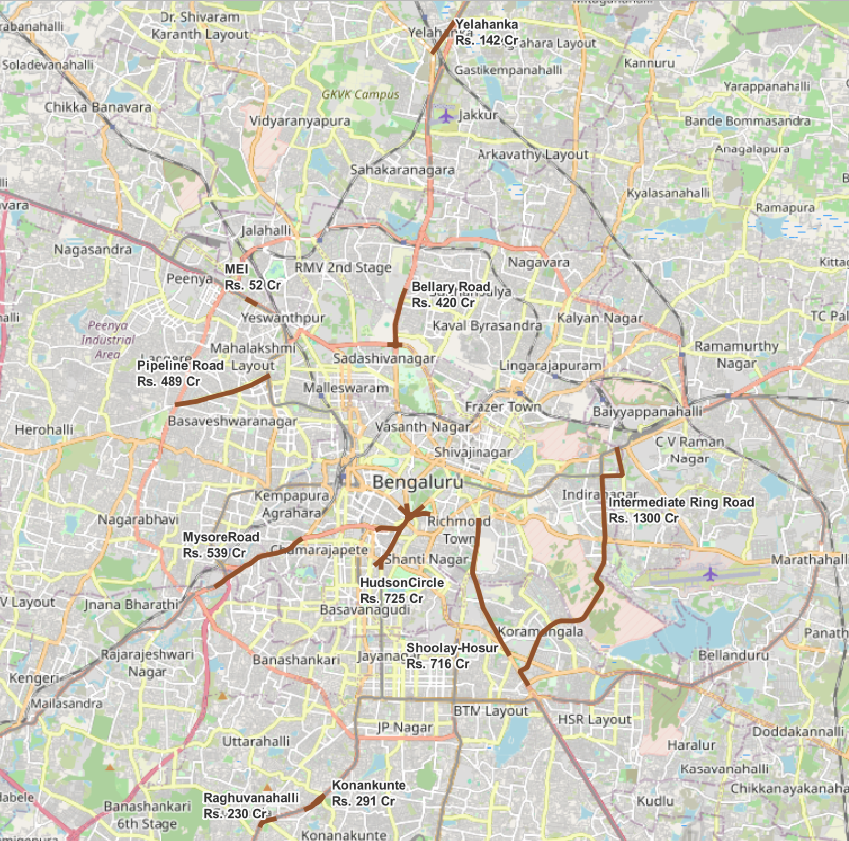
You can browse the flyovers, their approximate locations in the interactive map below. The flyovers are hand drawn using the drawings and the alignment shown in the DPR.